-
Call: +(91) 92577-55005
-
Email: info@dronetra.in
Industries Served
Dronetra is working throughout various Industries. We made a selection for you with specific case studies. Please ask for more reference when required.
Mining
The Mining Industry has its own challenges. Abrasive medium, temperature variations, accessibility and many more. Dronetra has supported clients into the most rural and harsh environments on the planet and successfully assessed the pipeline integrity. We also have extensive experience with HDPE tailing lines and specifically coated lines that are often used in the industry.
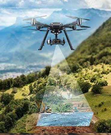
Drone survey has become an integral part of the mining industry delivering accurate results much faster than the conventional survey methods while being much cheaper than other expensive options such as Lidar survey. Our solutions help mining industry companies to do site monitoring digitize their lease areas, identify illegal encroachment and carry out inspection of plant areas. We provide insights from 3D visualization of mines to ensure robust inventory management and safety reviews.
LEASE AREA MAPPING
We have covered locations across India providing the much critical data required for digitizing their lease records and monitoring illegal mining & encroachment. Our detailed survey provides the companies with the necessary inputs for mining plan preparation, bench analysis, haul road analysis and compliances.


Energy
Solar Farm Inspections
With a passion for technology and drive to assist various industries, the renewable energy sector is flourishing with Drone Surveys. It is imperative to secure the quality of the solar power plant for adequate power generation, saving costs, and to maintain a long life of the asset. We offer timely thermal imaging (Aerial Solar) Inspections for Solar Power Plants to guarantee the safety and effective deployment of these solar systems.
Using professional drones with high flight times and drone pilots with specific experience in carrying out wind turbine blade inspection, we capture blade wise images using high-resolution cameras and zoom cameras on drones. Drone technology performs drone calculations and provide comprehensive report on the inspection carried out.
The industry needs to depend on cutting-edge UAV technology for solar farm Inspection, Monitoring, and large-scale maintenance. Our deliverables include geotagged high-resolution drone images and orthomosaics for quick decision-making. We have offered solar farm inspection services to more than 100 solar farms, and have assisted them continuously in procuring a higher return on investment.
Industrial
Oil and Gas
Oil and gas projects, refineries and plants have huge safety & operation critical assets that are to be monitored and inspected regularly to ensure safe operations. Dronetra provides drone services for oil and gas inspection & survey to help companies to maintain their assets better and improve safety. Our fleet of professional drones with high resolution cameras, thermal cameras Flir Vue Pro series and experienced drone pilots can inspect all your assets such as chimneys, flare stacks, pipelines, cooling towers and more to find out all types of surface defects.
Our drone inspection services with standard operating procedures help reduce asset shut down times, improve safety and reduce risk to manpower.
We provide comprehensive reports on the drone inspection carried out. Our reports consist of detailed information on the defects, claissification of damages based on their type & severity and location of the damage. The data is available on a cloud based platform and in PDF reports for easy visualization, analysis and decision making

Drone Services
Dronetra offers enterprises a cost-effective, efficient, and safe solution for their mapping and surveying needs,
providing them with accurate and reliable data that meets their business objectives.

Agriculture
Our agriculture drone services have helped countless farms and agricultural businesses nationwide monitor crops, manage irrigation, assist with precision agriculture, and much more. Start optimizing inputs and driving down costs today with drone solutions.
Surveying / Mapping
We extend services such as GIS, Drone Survey, Land survey, Stockpile Volumetric Analysis, Slope Monitoring, LIDAR, contours, and Urban Planning. Multiple deliverables offered include Orthomosaic maps, 3D Point Cloud, DEM, DTM with Centimeter-level accuracy, and 99% accurate Volumetric analysis and measurement.


Surveillance
Real time & accurate insight into security, Remote Area Inspection, Risk Assessment and perimeter control.