-
Call: +(91) 92577-55005
-
Email: info@dronetra.in
Drone Services
Dronetra offers enterprises a cost-effective, efficient, and safe solution for their mapping and surveying needs,
providing them with accurate and reliable data that meets their business objectives.

Agriculture
Our agriculture drone services have helped countless farms and agricultural businesses nationwide monitor crops, manage irrigation, assist with precision agriculture, and much more. Start optimizing inputs and driving down costs today with drone solutions.
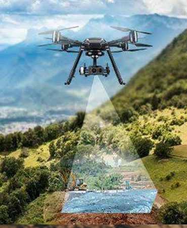
Surveying / Mapping
We extend services such as GIS, Drone Survey, Land survey, Stockpile Volumetric Analysis, Slope Monitoring, LIDAR, contours, and Urban Planning. Multiple deliverables offered include Orthomosaic maps, 3D Point Cloud, DEM, DTM with Centimeter-level accuracy, and 99% accurate Volumetric analysis and measurement.


Surveillance
Real time & accurate insight into security, Remote Area Inspection, Risk Assessment and perimeter control.
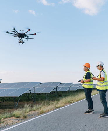
Inspection
Our Aerial Inspection services include infrastructure inspection, Powerline inspection, Wind turbine inspection, Solar panel inspection, Bridge Inspection, Railway track inspection, etc.

First Person View
We offers exceptional FPV drone pilots with years of experience. FPV drone services include filming, inspections, creating corporate video.
Industries Served
We offer highly accurate and detailed GIS Surveying, drone inspection, mining services, flood Assessment, crop health monitoring, topographic survey, UAV data processing, 3D mapping, and aerial photography and qualified personnel such as wind turbine experts.
Transportation

Mine Survey

Energy
